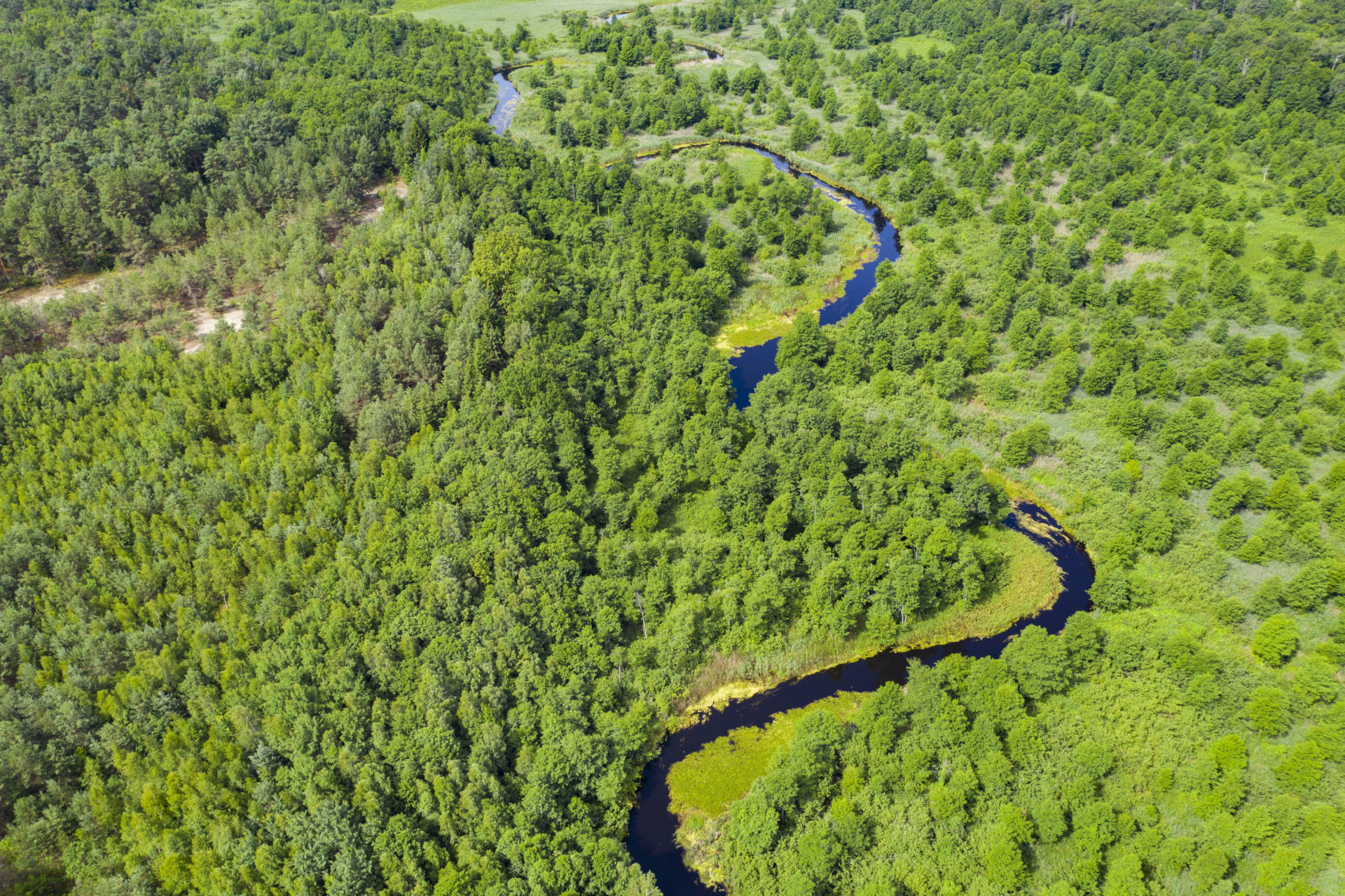
Satellite images show evidence that between July and October 2020 the Pripyat, one of Europe’s most pristine rivers, has been dredged at at least seven sites in Ukraine. All of them lie within the Chernobyl exclusion zone – the most contaminated area of the world. Five sites are even located within a distance of ten kilometres to the Chernobyl nuclear power plant. The purpose of the dredging works was to deepen the river beds to a navigable depth of 1.6 metres and width of 35 metres.
The Ukrainian government commissioned the dredging works. Its Ministry of Infrastructure produced a map containing eight planned dredging sites along the Pripyat river. The following satellite images indicate that the river has been dredged at at least seven and very likely at all eight sites:
![]()
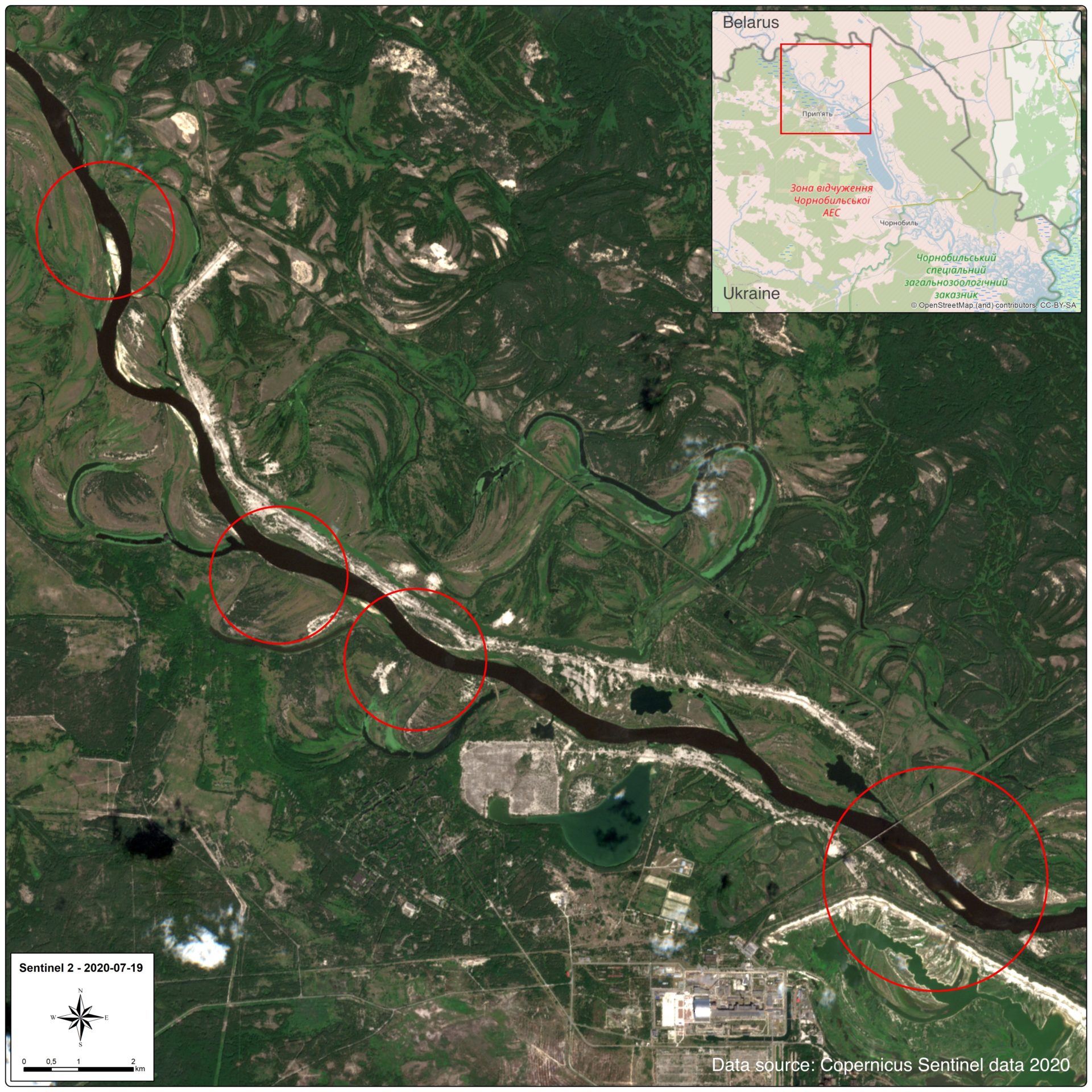
The Sentinel2 satellite image taken on July 19th 2020 shows the regular course of the Pripyat river in Ukraine. There are no visible signs of dredging. The remains of the Chernobyl nuclear power plant and cooling pond lie between the third and fourth circles (Data source: Copernicus Sentinel Data 2020). ![]()
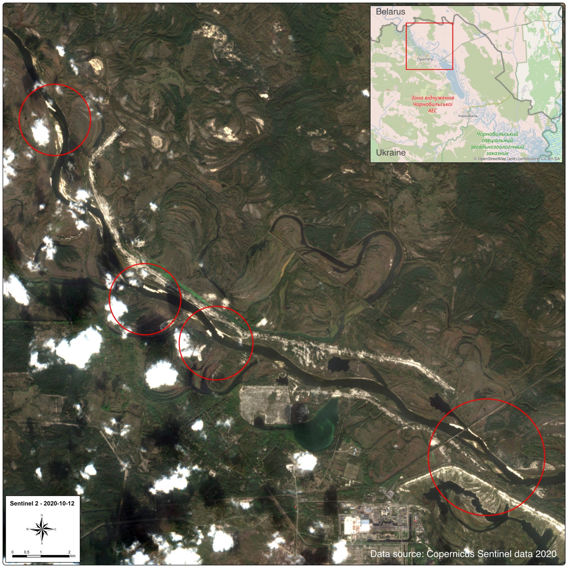
The Sentinel2 satellite image taken on October 12th 2020 shows that within the encircled areas a high amount of sediments is stirred up in the Pripyat river, indicating that dredging took place. Those areas appear in bright colour due to higher light reflection. The remains of the Chernobyl nuclear power plant and cooling pond lie between the third and fourth circles (Data source: Copernicus Sentinel Data 2020).
![]()
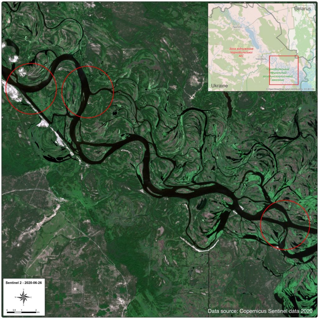
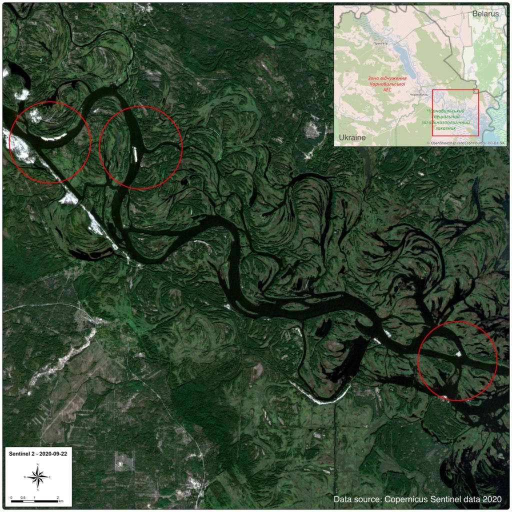
The Sentinel2 satellite image taken on June 26th 2020 shows the regular course of the Pripyat river in Ukraine. There are no visible signs of dredging (Data source: Copernicus Sentinel Data 2020). ![]()
The Sentinel2 satellite image taken on September 22nd 2020 shows that within the encircled areas a high amount of sediments is stirred up in the Pripyat river, indicating that dredging took place. Those areas appear in bright colour due to higher light reflection (Data source: Copernicus Sentinel Data 2020).
When dredging was launched earlier this year the dredging company involved, SOBI, publicly stated that their work is part of the E40 waterway. The tender of almost 12 million UAH (around 410,000 EUR) was awarded to SOBI for dredging of 100,000 m3 of sediments. This tender was issued without an Environmental Impact Assessment (EIA) as required under Ukrainian law (Water Code and EIA law). There should have been prior assessment of the 2020 dredging activities including public participation.
Further on September 30th 2020, the Cabinet of Ministers of Ukraine adopted a resolution “On Amendments to the List of Inland Waterways, which belong to the category of navigable waterways”. This List includes areas of the Pripyat river where the bottom was deepened over the past four months. The explanatory note to the Resolution of the Cabinet of Ministers states that these areas are part of the E40 waterway.
There are many examples of large and complex infrastructure projects being built piecemeal. It seems like this is happening with the E40 waterway project as well. The Save Polesia coalition is demanding a comprehensive strategic assessment of all risks and benefits of the E40 waterway, including radiation risks, to inform a strategic decision on this mega infrastructure project through Europe’s largest wetland wilderness. Individual ‘slices’ of the E40 waterway should not be progressed until such an assessment has been undertaken.
Further information:
• Find out more about Polesia
• Learn more about the threats from the E40 waterway