Frequently asked questions
The route of E40 waterway
Where is the E40 waterway proposal?
The E40 waterway will link Gdansk on the Baltic Sea to Kherson on the Black Sea via Poland, Belarus and Ukraine –please see this interactive map: https://savepolesia.org/the-threat/
On this, you can zoom out to see the full length of the E40 proposal, or zoom in to see specific elements, including proposed Siarzewo dam north of Warsaw.
How much of the 2000km of rivers along the E40 waterway’s route would be affected?
About 600 km of the E40 waterway route are in Poland, 650 km in Belarus and 970km in Ukraine. E40 waterway would be designed for ships more than 80 meters in length. To accommodate them the channel must be at least 2.5 meters deep. To enable this works will be needed on a very large part of the 2000 km. While the E40 waterway might appear a complete route on the map, some of its sections are either completely unsuitable for shipping or have low shipping classes (I-III), meaning they are not suitable for freight transport. For example, in Poland only 66.5 km of the Lower Vistula (55 km of Wloclawek reservoir and 11.5 km of “Dead Vistula”) is currently at the required international technical standards for freight transport.
Hence, to make E40 waterway fully navigable to shipping class IV (the requirement for an international waterway) extensive infrastructure works would be needed, including: 12-15 dams on the Vistula in Poland, the roughly 160 km of new channel with seven locks in Poland, between five and seven dams in Belarus, and extensive dredging and channel straightening, including in the Chornobyl Exclusion Zone. Works of this extent would make this one of the most complicated, expensive and destructive to nature construction projects in the world.
Aren't Inland Waterways a green form of transport?
When thinking about how green a mode of transport is, it is important to think about both the impacts of construction of the infrastructure and of its use. The emissions from the use of inland water transport are lower than road transport, although electric rail is still lower. Development of inland waterway infrastructure can be sustainable with appropriate route selection and sensitive planning with the environment in mind. But E40 is not such a case.
While often described as a project to ‘restore’ an existing waterway, this hides the reality that construction of E40 will require very significant engineering works – dredging, damming, straightening and deepening and – causing irreversible damage to natural habitats of some of Europe’s last major undamaged rivers and their valleys. Maintenance of the waterway will, in some sections, lead to the drainage of wetlands, which also leads to the release of greenhouse gases. Further, water reservoirs made by the dams upstream are major emitters of methane (a greenhouse gas). Thus, E40 cannot be considered as a green form of transport.
Will construction of the E40 waterway also mean development of renewable energy?
Even if hydropower plants on river ecosystems are still considered a renewable energy source, they are no longer treated as “ecological”. Breaking the river continuum (migration of organisms and genes, transport of debris, organic matter and elements), changing the river ecosystem into a quasi-lake ecosystem, changes in temperature and other physical/chemical properties of water, destruction of natural habitats and the habitats of species associated with the natural river channel and floodplains are just some of the negative effects of the construction of shipping channels and power barrages planned to develop the E40 waterway.
Will the E40 waterway be safe for fish populations if the barrages are built with fish passages?
The impact of barrages on fish populations is not limited to a physical barrier interrupting migration. The fish moving downstream are killed and injured in the turbines of hydroelectric power plants built on barrages (mortality rate up to 90%). Reservoirs without rapid current, which is a kind of “signpost” for migrating fish, are serious behavioral barriers both for adult fish moving upstream and juveniles moving downstream. Fish get lost in the stagnant water, so the adults do not reach the spawning grounds on time, and the young fall prey to predators. Warmer water with changed chemical parameters (e.g. increased concentrations of nutrients) in a reservoir poses a threat to current-loving fish species.
The importance of fish passes as a means of minimizing the impact of transverse barriers on fish populations is often overestimated. When there are many barriers on the way to spawning grounds, even effective fish passages are not able to ensure the sustainability of the population. About 10 barrages are planned on the E40 waterway section between the Baltic Sea and Warsaw. Even if each of these included a fish passage with an efficiency of 85%, no more than 20% of the fish population would reach the spawning grounds in the catchment area of the upper Vistula. For 15 barriers it would be only 9% of the fish population.
Is it true that construction of E40 waterway would not involve concreting rivers, the only change would be deepening?
The construction of the E40 waterway to international standards implies achievement of certain minimum technical standards – for the depth and width of the channel and the radii of the bends, so that ships of more than 80 meters in length could use it.
This means a complete change in the shape of the riverbeds and river valleys. One of the effects of these changes to concentrate the water for the needs of shipping will be less frequent flooding, which will lead to degradation of the floodplain nature, and even worse – limiting the supply of groundwater, including for drinking water, and increased flood risk for people living in the river valleys.
Waterways can’t be built without concrete. It is the main component of barrages, and the strengthened riverbanks constructed to keep the river “under control” are built of concrete. For example, during the construction of the Włocławek barrage on the Vistula river, 400,000 m3 of concrete was used, and for the Malczyce barrage on the Oder River – 120,000 m3 of concrete and 20,000 tonnes steel were used. On this basis, it can be estimated that for the construction of 19 barrages on the E40 waterway planned between Gdańsk and Brest, more than 5 million m3 of concrete and 0,5 million tonnes of steel are needed!
Are there alternatives?
The main alternative to E40 waterway is rail transport which is quicker and greener. Expert economic analysis has shown that travelling along the E40 route in Poland would take only 19 hours by train rather that 5 days by boat, and that the external costs (eg air pollution, climate change, accidnets) of freight transport by rail would be 2.5 times less.
Investments in the quality and speed of the existing rail network between the Black Sea and the Baltic would be much more sustainable than in E40 waterway construction. Transport of goods using the E40 waterway would be slower, more expensive, more polluting, and less reliable than electric rail.
Planning and implementation of E40 waterway
Is the EU involved in the E40 waterway project?
E40 waterway is not an EU project, rather a political initiative of the three countries (Poland, Belarus, and Ukraine) and is included in the European Agreement on Main Inland Waterways of International Importance (an UNECE agreement). For more information, see UNECE’s page ‘Where to navigate? The network of inland waterways in Europe and its parameters’, also the map of the European Inland Waterway Network.
However, the European Union did provide funding for a Feasibility Study on the E40 waterway project, which was published in 2015. The EU is also currently supporting a project to look at improving inland waterway transport on the Lower-Middle Dnieper (the section from the Black Sea up to Kyiv – so technically part of E40, but which is already a navigation route although currently in poor condition) – see here.
What is the current position?
In the current context, with the war in Ukraine, the E40 waterway project is not being taken forward as a single coherent international project. However, the three countries are still committed to their stretches of the waterway and are taking forward individual projects – see the individual country sections below.
Hence we want to shine a light on the issue now and avoid the situation where many individual projects (‘small’ pieces of E40) are taken forward separately. We see an immense danger of this fragmented ‘salami-slicing approach’ that builds the argument for completion of the entire waterway over time as the political situation changes.
What about the longer-term?
E40 waterway is still very much an international aspiration – it is included in the network of European inland waterways and ports of international importance, European Agreement on Main Inland Waterways of International Importance (AGN), see the map here. And although this map is from 2018, the convention bodies meet regularly, most recently in February 2023, and E40 is still included in current documents.
What is a salami-slicing approach?
It is a way of taking forward a major infrastructure project (such as E40 waterway) through many separate smaller projects that are not obviously related to each other enabling implementation of a big project by stealth. This approach is used in order to hide from people what is actually planned, what impacts the whole big project will have, how much its implementation will cost.
Hence salami slicing is a legal approach – to avoid certain legal thresholds, e.g. those for Environmental Impact Assessment. But also a political approach to avoid a proper societal debate on the E40 waterway.
In Poland, they are hiding separate projects from the big E40 waterway plan across at least five different strategies.
Poland
What will E40 waterway in Poland involve?
In Poland the E40 waterway will follow the Vistula River for approximately 440 km from Gdansk on the Baltic Sea to Deblin. On the Lower Vistula between Gdansk and the mouth of the Narew River just north of Warsaw it will include a cascade of eight dams (the Lower Vistula Cascade). On the Middle Vistula upstream of the mouth of the Narew River to Deblin a cascade of five more dams (the Middle Vistula Cascade). From Deblin a new channel will be constructed to Terespol on the border with Belarus. This roughly 160 km new channel will have seven locks in Poland.
What will the impacts be?
There will be devastating impacts on biodiversity. Our research shows that 86 international and 82 national protected areas would be impacted in Poland by E40 waterway. At least 13 international sites in Poland would have serious impacts.
66 Natura 2000 sites would be impacted in Poland – a total area of 5,182 km2, almost 8.5 percent of the Polish Natura 2000 network area. The E40 waterway would not just cross Natura 2000 sites, but go along whole sites. Nine sites would be affected along their whole length. As a result, Polish breeding populations of Little Tern, Eurasian Oystercatcher, Common Ringed Plover and Mew Gull would decrease by half.
We are especially worried now about Lower Vistula Valley SPA between Włocławek and Gdańsk. In this fragment, the Vistula, despite its transformations, retains the natural character and dynamics of a freely flowing river. There are vast areas of wet meadows in some places between the flood embankments.
The plans for dam construction in the site and construction of further dam reservoirs along the river up to the estuary (known as “Lower Vistula Cascade”) put this area under threat.
The Lower Vistula Valley is one of the most important national breeding sites for the Little and Common Terns. Lower Vistula Valley is also an important place of rest on migration (including groups of waders of 25,000 individuals) and a wintering area. This is mainly due to the variety of habitats occurring here.
In addition, an important ecological corridor for Atlantic Salmon and River Lamprey passes through Lower Vistula. This part of river is significantly important for such fish as Asp, European bitterling, Spine Loach and Weatherfish.
Another study reveals that E40 would have severe negative impacts on river water resources in Poland. The channel requires a massive amount of water which can be provided only by the Vistula and Bug rivers.
E40 waterway would cause severe changes to the flow of the Bug river, especially in periods of drought. Use of water from the Bug or from the Vistula would require uphill pumping of large amounts of water, which would be expensive and may not be technically feasible.
Using water from the Bug river for any of the variants projected by the 2015 feasibility study will have a serious impact on the environment: overbank flows would reduce by an average of 17.5% and the frequency of droughts would increase by a shocking 172% (more than 2.5 times as many droughts).
The channel will drain local groundwater in many sections which could have severe negative consequences for local agriculture, households, and the environment.
Changes to hydrology would impact large catchment areas, including peatlands and other wetlands. The catchments of the Tyśmienica, Bystrzyca, Wieprz, and Wilga rivers have 62,500 ha of peatlands, which could be seriously impacted by reduced groundwater levels. This would damage the quality of habitats and their ability to store carbon. There are also ten Special Protection Areas (in total ca. 85,500 ha) and 17 Special Areas of Conservation in these catchments that have water-dependent species, or habitats in their conservation objectives that could be adversely affected by a reduction in groundwater across the region.
There is also a serious economic impact. The construction of the roughly 700 kilometer-long Polish section of E40 waterway is too expensive to be economically viable. Even under optimistic scenarios, long-term losses in the Polish section alone would amount to billions of euros of taxpayer’s money. The most likely route would end up losing taxpayers more than €6.5 billion. But because real construction costs frequently exceed estimations by a wide margin, it is likely that these losses would be far higher.
Does the EU require Poland to develop inland navigation and build "water highways"?
The “White Paper on Transport: Roadmap to a Single European Transport Area : Towards a Competitive and Resource-efficient Transport System” sets 10 targets to “enhance the growth of the transport sector and support mobility while meeting the 60% emission reduction target”. Goal (3), quoted by shipping advocates, states “30% of road freight over 300 km should shift to other modes such as rail or waterborne transport by 2030, and more than 50% by 2050, facilitated by efficient and green freight corridors. To meet this goal will also require appropriate infrastructure to be developed.”
In Poland, this means transferring loads from trucks to rails and expanding the railway infrastructure. This solution is supported by objective (10): “Move towards full application of “user pays” and “polluter pays” principles…”, which lobbyists for waterways consistently keep silent about. So far, in Poland, the regulation of rivers, the construction and maintenance of locks and barrages is paid for by taxpayers, and the profits go to hydroelectric power plant operators and shipping companies.
What has happened on the planning and implementation of E40 waterway in Poland?
E40 waterway is currently most active in Poland. The Polish authorities have commissioned a number of technical studies, but these have not been published or made available to NGOs and the public.
- Notably in 2018 the Polish authorities commissioned a national Feasibility Study to inform detailed route selection in Poland. This was initially due to be published early in 2020, then by the end of 2020, but is still not public (although we know it was finished some time ago).
- Also, an analysis looking at the current condition of the inland waterway transport sector in Poland and the potential for modernization of the Oder and Vistula waterways. Again, this is not available (although we know it is finished).
- Our Polish partner (OTOP-BirdLife Poland) has made a number of ‘access to information’ requests or court challenges to try and get hold of these documents. But access to information and transparency of decision-making in Poland is currently a real challenge.
- Despite the lack of a strategic decision in Poland the E40 waterway seems to be developing by stealth in small sections. For example, construction works of the shipping channel through the Vistula split proceeded despite live court challenges to the consents, and the same may happen with the Siarzewo barrage project. In theory, the Polish law allows the environmental consents to be challenged and the consent is not final until the challenge has been concluded. But the NGO challenge to the Siarzewo decision has not been concluded after five years and in the meantime the authorities continue to prepare for construction, so we fear the Vistula lagoon situation will be repeated and that this is a deliberate tactic.
What is the current position?
The Polish government has big plans to develop the wild Lower Vistula – including Siarzewo barrage and four other dams and 361-1600 groynes – artificial structures to channel and speed up the natural water flow. This will have a devastating impacts on valuable landscapes and precious biodiversity. Separate projects that are part E40 waterway plan have been salami-sliced across at least five different strategies, including a programme for Comprehensive development of the Lower Vistula.
On 22nd of January of 2024, we presented the petition signed by more than 143 000 people against Siarzewo dam and the E40 waterway at the PETI Committee’s monthly hearing in Brussels.
The European Commission committed to having a structured dialogue with Poland to find out more about what is going on with Siarzewo barrage and E40 waterway plans. The PETI Committee decided to keep the Petition open to await updates and progress.
What is the connection of Siarzewo barrage to the E40 waterway?
- E40 as described in the 2015 Feasibility Study and in the interim outputs of the Polish Feasibility envisages a cascade of eight dams/barrages on the Lower Vistula north of Warsaw, one at Siarzewo, in addition to the single existing dam at Wloclawek. Also a cascade of dams on the Middle Vistula (south of Warsaw). The dams on the Vistula (such as Siarzewo) would be for the waterway (to maintain the water levels) and for power generation.
- The Polish government is proceeding with planning for Siarzewo barrage – saying it is needed for a whole range of reasons including inland water transport, safety, water resources, and renewable energy. They are treating it as a standalone project, but in fact, it will be the first ‘salami-slice’ of the E40 waterway project. All these needs can be more easily provided in alternative ways with much fewer adverse impacts on the environment, bringing the project and plans to progress it into question.
Will the EU finance construction of Siarzewo barrage?
Only those waterways that have been classified as part of the TEN-T network can count on EU financial support. Poland has only a short section of the lower Oder below the connection with the Odra-Havel canal in the TEN-T. The Siarzewo barrage is not included in this roadmap.
Will the E40 waterway and other waterways in Poland be co-financed from EU funds, including the Recovery and Resilience Facility?
According to Article 5(2) of the Recovery and Resilience Regulation 2021/241, only actions in accordance with the principle of “do no significant harm” (DNSH) can be supported by the Recovery and Resilience Facility. This principle is defined in detail in Article 17 of the ‘Taxonomy’ Regulation 2020/852, which lists, among other activities causing serious damage, those that harm the good status or ecological potential of surface water bodies and the good status and resilience of ecosystems or the conservation of habitats and species, including habitats and species of EU interest.
The guidelines of the European Commission on the application of this DNSH principle make it clear that the construction of dams on free-flowing rivers has no chance of being financed from Recovery and Resilience Facility funds. Given that the construction of the E40 waterway in Poland threatens the integrity of at least 14 Natura 2000 sites and the environmental objectives of numerous water bodies, there can be no question of compliance with the principle of “do no significant harm”. In addition, the investment will be contrary to Article 6 of Directive 92/43/EEC (Habitats Directive) and Articles 2, 3 and 4 of Directive 2009/147/EC (Birds Directive).
Will the Bug River be affected?
The Bug River will not be directly used as part of the E40 waterway channel – rather the impacts on it will be indirect, because of changes in hydrology as water is taken for the new E40 channel. The magnitude of the impact on the Bug will depend on which route variant is chosen for this stretch of the E40. If you have a look at the sources below you will see the maps and possible impacts.
On our website we highlight the route via Deblin (V3) as this was the one being assessed in detail in the Polish Feasibility Study. This work was finalised in 2020, but the results have never been published despite our many requests to the Polish government, so we cannot yet be sure about the chosen route.
Read more in our factsheet ‘E40 waterway would lead to droughts, and destroy rivers and wildlife in Poland’ and in the ‘Analysis of selected possible impacts of potential E40 International Waterway development in Poland on hydrological and environmental conditions of neighbouring rivers and wetlands – the section between Polish-Belarusian border and Vistula River’.
Ukraine
What will E40 waterway in Ukraine involve?
In Ukraine the E40 waterway will follow the Dnipro River for approximately 910 km from Kherson on the Black Sea to the mouth of the Pripyat. Then for about 60 km the Pripyat through the Chornobyl Exclusion Zone (CEZ) to the border with Belarus. South of Kyiv the Dnipro has previously been navigable, but already before the war was in poor condition. Rehabilition of the existing six locks and navigation channel will be needed. From Kyiv north extensive new works will be needed including dredging and channelisation in the CEZ.
What will the impacts be?
Our expert research shows that 43 international (15,676 km2) and 18 national protected areas (3,137 km2) would be impacted by E40 waterway in Ukraine. 31 international (total area 12,922 km2) and 16 national protected areas in Ukraine would be impacted directly. Key biodiversity hotspots that would be impacted by E40 are National Nature Park Pripyat-Stokhid and Chornobyl Radiation and Ecological Biosphere Reserve in Ukraine.
Pripyat-Stokhid park is Polesia’s largest protected area. It is one of the most unique natural complexes in Europe and a wetland of international importance, providing a home to a myriad of species. It is located in the valleys of the rivers Pripyat and Stokhid which have numerous tributaries and islands. The park is a place of seasonal migration of birds (120 000-150 000 birds). It is the only nesting place of the Azure Tit in Ukraine. The largest population in Ukraine of globally threatened species Aquatic Warbler (2100-2800 singing males) is found in sedge marshes of the park. Other rare bird species include nesting Black Stork, Crane, Lesser Spotted Eagle, Curlew, Snipe, Corncrake, Hazel Grouse, Capercaillie, Eagle Owl, Green Woodpecker, Stock Dove and Roller. Among the rare mammals are Grey Wolf, Weasel, Otter, Eurasian Lynx, European Polecat.
Chornobyl Biosphere Reserve is located in the Dnieper river basin and includes a large part of the exclusion zone created after the Chornobyl accident. The reserve has very rich diversity, including 19 different habitat types.
Ungulates (Red deer, Roe deer, Elk, Wild boar) and predators are numerous. A very rich group of birds is represented by wetland, forest, and farmland species. The area is not only nesting and roosting ground, but also stop-over for migrating species as the Dnipro flyway crosses the area.
Among rare mammals are Eurasian Lynx, Otter, Weasel, Badger, Grey Wolf and Brown Bear. Among rare birds are Black Stork, Crane, White-tailed Eagle, Lesser Spotted Eagle, Black Grouse, Hazel Grouse, Green Woodpecker , Stock Dove, Roller.
The area was originally heavily modified by human activity. But now in most parts of the CEZ the limited management and almost complete absence of people is helping rich nature systems to recover.
According to the 2015 information extensive dredging of the Pripyat will be needed to reach the required depths for vessels including in the CEZ. Moreover, a dam is proposed within the CEZ just upstream of Pripyat city. Given the radiation contamination in the CEZ there are understandably serious concerns about the potential impacts of E40 waterway. Despite these concerns worryingly initial dredging took place in the CEZ in 2020 without prior environmental assessment. The Ukrainian cabinet amended the official list of navigable waterways to include future E40 waterway on the Ukrainian Pripyat, including in the CEZ, which led to a revision of the zoning plan of the Chornobyl Biosphere Radiation and Ecological Reserve and the removal of this part of Pripyat River from the list of areas with high conservation status. According to the developed new zoning, the riverbed of the Pripyat in the southern part of the Reserve will belong to the zone of anthropogenic landscapes, and its channel in the northern part – to the buffer zone.
Expert analysis made in 2020 showed that dredging inside the CEZ could disturb several radiation hotspots, resuspend contaminated sediment which the International Atomic Energy
Agency recommends leaving undisturbed, expose construction workers to dangerous levels of radiation, and pose an increased radiation risk through contaminated water for millions of people.
According to Wetlands Conservation Centre study, available water resources in Ukraine might initially be sufficient for the E40 waterway to function although this is likely to change with climate change. Longer and more severe droughts are likely to increase the use of water for agriculture, which would limit the water available to feed the E40 waterway in June to September – the most critical periods of the year. The experts hypothesize that the main environmental threats posed by E40 waterway are related to issues of periodic shortages of water caused by the projected climatic change, hydromorphological pressures related to the requirement of river regulation in its natural stretches and affected water balances of valuable peatland sites.
What has happened on the planning and implementation of E40 waterway in Ukraine?
- In 2020 the Ukrainian authorities progressed dredging of the Pripyat. Depending on the audience, they changed whether this was referred to as part of E40 implementation or not.
- In 2021, the Ukrainian authorities adopted a position that work on E40 should not proceed until there is more detailed analysis and that the Polish section is key.
- On the 29th of July 2022, Ukraine terminated its bilateral agreement with Belarus on inland navigation which, without directly mentioning the E40 waterway, laid the groundwork for its implementation.
- In July 2022 the European Commission adopted an indicative TEN-T map for Ukraine which includes most of the Ukrainian section of E40 (from Kherson to the Pripyat River in the Chornobyl Exclusion Zone). It is very hard to understand the rationale for inclusion of the Kyiv reservoir and the first 14 km of the Pripyat River.
- In November 2022, an agreement on inland navigation was signed between the governments of Belarus and Russia. This agreement allows Russian vessels to use the waterways of Belarus. This is part of the current political situation in the region which makes joint Ukrainian-Belarusian navigation on the Pripyat River highly unlikely.
What is the current position?
The status of E40 waterway is currently confused and concerning.
Almost all of the Ukrainian stretch of E40 is included in the European adopted TEN-T (trans-European Transport Network) indicative map for Ukraine and is proposed to be included in the revised TEN-T legislation which is currently being negotiated. Inclusion here cements this section as a priority and would open the door for EU funding. Particularly in light of the extensive funding that will flow into Ukraine for reconstruction.
Under the current circumstances of the undermining of the Kakhovska hydropower plant in Ukraine (June 6, 2023), shipping from Kherson to Kyiv will be impossible for at least 5 years if the war stops in 2023, according to the head of the state company “Ukrhydroenergo” Ihor Syrota. If the war drags on, it is difficult to predict the time of restoration of shipping.
Experts from the Environment Agency Austria suggest that re-building the dam and reservoir should not be the only option considered for this river area. Since the water supply problem needs urgent resolution, the former reservoir might after the war no longer need to serve its main purpose and could instead be left as a protected, self-restoring natural river area.
Belarus
What will E40 waterway in Belarus involve?
Approximately 650 km of the E40 Waterway will be in Belarus. From the Polish border at Brest the E40 waterway will follow the Mukhavets and Pina, Rivers and then for over 450 km the Pripyat one of Europe’s wildest from Pinsk to the border with Ukraine. Between five and seven dams are proposed including in the exclsuion zone and and extensive dredging and channel straightening. For more information on the Pripyat and possible impacts – see the separate section on this below.
What will the impacts be?
E40 waterway would lead to huge impacts on biodiversity in Belarus. 65 international protected areas (10,615 km2) would be impacted by the channel. Almost half of this area (18 sites) would be impacted directly. In addition, 39 national protected areas (8,087 km2) would be impacted by E40, more that half of this area (8 sites) directly. All of the international and national sites with direct impacts are likely to have serious impacts. 13 international and 6 national sites with indirect impacts are also likely to have serious impacts.Among key biodiversity hotspots that would be impacted by E40 waterway are Pripyatsky National Park and Almany Mire in Belarus.
Pripyatsky National Park protects the middle stretch of the river Pripyat. The park is internationally protected and is one of the least disturbed areas of Belarusian Polesia. It provides vital ecosystem services: the floodplains provide flood regulation, human water supplies, maintain water quality, and recharge groundwater. The peatlands store and sequestrate carbon, helping to regulate the global climate. Any damage to this unique ecosystem would be an international catastrophe.
In spring, as snow melts, vast wetlands form and this area is more like a large lake than a river. Its landscape is a huge labyrinth of diverse habitats – waters, islands, swamps, wetlands, and floodplain forests. The site harbours numerous nationally-rare species of flora and fauna which are important for the conservation of biological diversity in Europe. The high diversity of habitats means there is a high diversity of species in a limited area. The park is a key site for migratory birds. Here are nesting such rare birds as globally threatened Greater Spotted Eagle, Snipe, Pintail, Bittern, Black Stork, Black Kite, White-tailed Eagle, Short-toed Snake Eagle, Crane, Golden Plover, Curlew, Little Tern, and White-backed Woodpecker.
Covering 100,000 hectares, Almany is the largest transition mire in Europe. The main part of the mire complex is located in Belarus. The site stores a huge amount of carbon and provides a home to Belarus’ largest population of the globally endangered Greater Spotted Eagle. Almany Mires Nature Reservehosts a wide variety of bird species, including over 20 nationally protected species and over 40 internationally protected species. Many of them are wetland-related species, including Europe’s largest population of globally threatened Greater Spotted Eagle (18-20 pairs); the largest populations in Belarus of Short-toed Eagle, Crane, Greenshank and globally threatened Aquatic Warbler.
The Wetlands Conservation Centre research published in 2020 shows that climate-induced pressures will affect water availability for the E40 waterway. Experts consider the biggest problem for the E40 waterway will be changes to rivers upstream in Belarus, where the water resources of the rivers forming the upper parts of the waterway are relatively small. Water resources in Belarus would only initially be sufficient for the waterway to function but not enough to maintain it in future.
The most significant impact of the E40 waterway in Belarus is likely to result from modification of the meandering stretches of the Pripyat river, one of the last Europe’s near-pristine major lowland rivers. Channelisation is likely to affect sediment levels and impact aquatic organisms like crustaceans, molluscs and insects as well as fish communities. During operation the E40 waterway is likely to have a wide range of impacts, for instance fishery management may be threatened and invasive species may spread.
What has happened on the planning and implementation of E40 waterway in Belarus?
- In 2020 dredging was undertaken at Kobryn and eviction notices were issued on land to be used for the proposed river port in Nijniye Zary near the Ukrainian border.
- On the 22nd of February, 2022 Belarus adopted a new National Strategy for Water Resources Management in the Conditions of Climate Change for the period up to 2030. It describes E40 waterway mainly as a possibility for economic and tourism development but also mentions that it may entail a threat to environmental safety, biodiversity hotspots, and archeological sites.
What is the current position?
According to information submitted to UNECE (see para 45 UNECE’s report) Belarus is working on eliminating bottlenecks and ongoing projects on the E40 waterway, including upgrading hydraulic structures on the Dnieper-Bug canal and relocating Brest river port. Hence it seems that Belarusian sections of the E40 are planned to be constructed in individual bits, as in Poland and Ukraine, so we are worried about a salami slicing fait accomplice.
Polesia
Where is Polesia?
Polesia is located in the borderlands of Poland, Belarus, Ukraine and Russia – please see this interactive map – https://savepolesia.org/polesia/ – with the buttons on the right of the map you can see the vast number of internationally protected areas in Polesia and also some of the key biodiversity hotspots (both in Polesia and wider in Poland).
The three countries involved in the E40 waterway project have different spellings for ‘Polesia’ – in Belarus “Palessie”, in Poland “Polesie”, in Ukraine “Polissya”. For their international website/work the Save Polesia partnership uses the English international spelling Polesia for consistency.
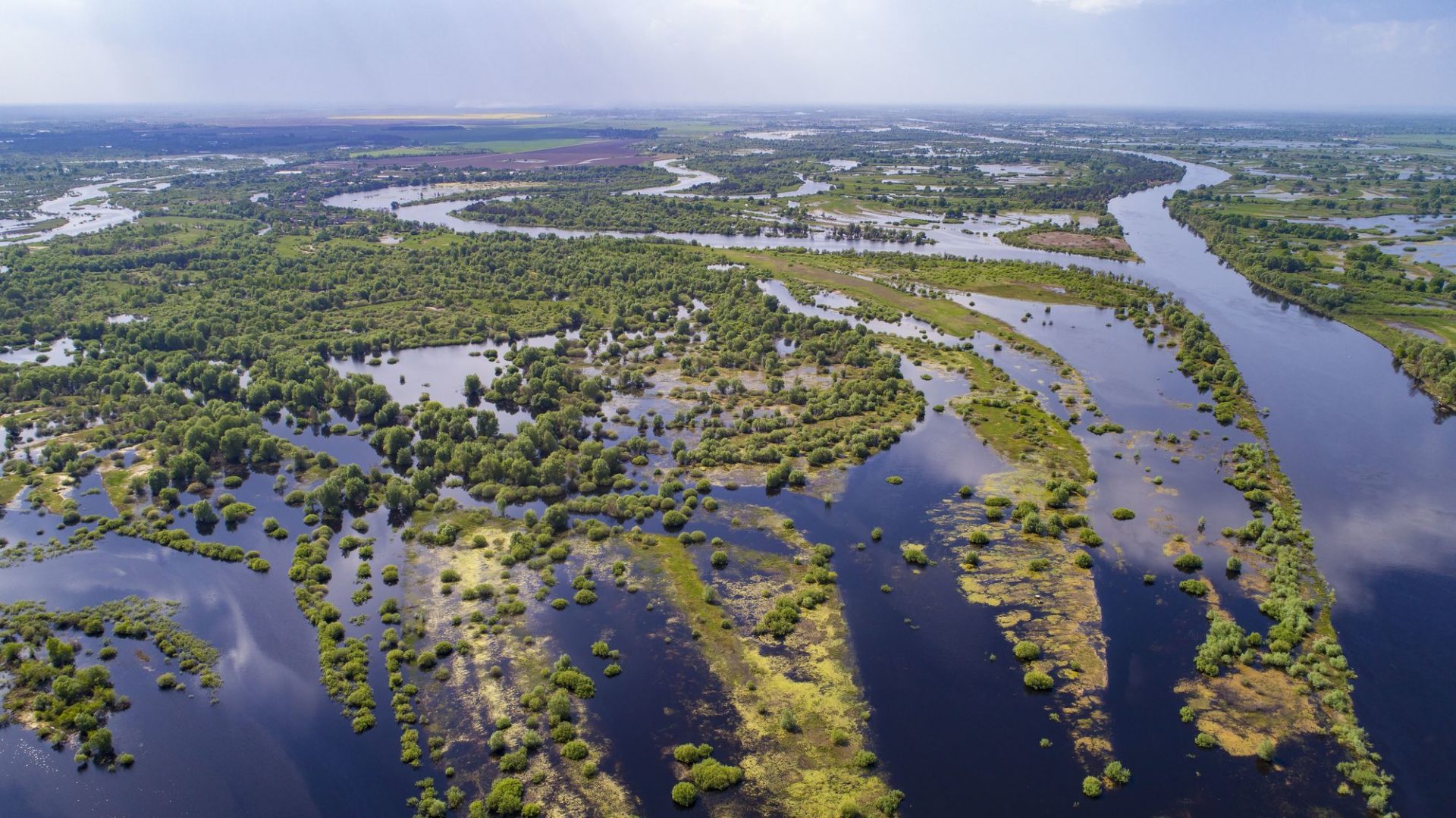
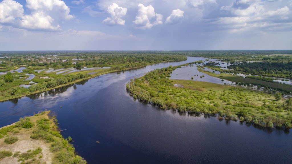
The Pripyat, one of Europe’s most pristine rivers
The 750km long Pripyat River lies at Polesia’s heart. Here we look in more detail at the Pripyat and what construction of E40 waterway might mean for the river.
What might be built on Pripyat?
According to the 2015 Feasibility Study, the E40 waterway will be used by ships up to 114 metres in length and more than 20 metres in width. The Pripyat is a very winding river so significant changes will be needed to accommodate such boats. These are likely to include straightening of numerous bends, construction of from five to seven new locks/hydroelectric facilities, connection of the Pina and Mukhavets rivers to the Dnieper-Bug Canal and extensive dredging and deepening of the middle reaches of the Pripyat riverbed, where Mid-Pripyat State Landscape Zakaznik, one of the country’s most important nature reserves is located.
The Feasibility Study estimated the cost of these works would be 60-120 million euros. But independent experts believe this is a significant underestimate and that the total construction costs of the Belarusian section of the E40 may be about 1 billion euros, excluding the cost of a new port near the village of Nizhnie Zhary.
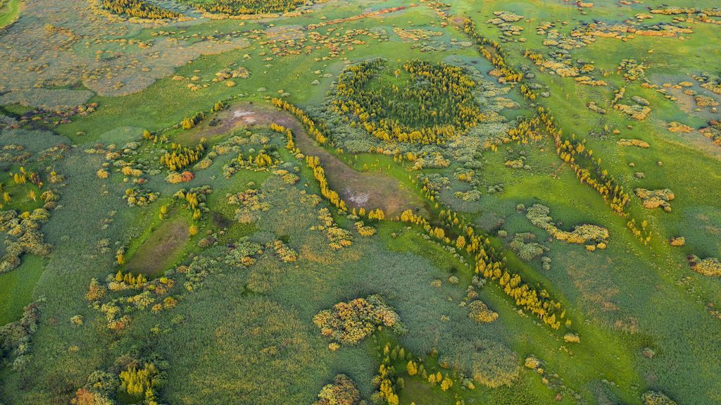
How might E40 affect wetlands?
Construction of E40 waterway will drastically change the water regime of the rivers, especially their floodplain sections. At this stage it is hard to predict exact changes, but some meadows and lowland marshes will be flooded to store water needed for ships to pass through the locks. Other floodplain meadows, swamps and forests will be cut off from the river by embankments and channel straightening and dry out or permanently flooded by the waters of constructed reservoirs.
What’s special about the Pripyat?
The Pripyat is a transboundary river, about 500 km of its length is in Belarus, and 200 km in Ukraine. Its river basin (or area from which water enters the river) is large, covering 114,300 km2, an area about the same size as Bulgaria or Greece. 50,900 km2 of this area is in Belarus – about a quarter of the country’s territory.
Another important feature of the Pripyat basin in Belarus is its flat character. Because of this, spring floods on the Pripyat are up to 20 km wide! These are a hallmark of the region and have led to the Pripyat being known as Europe’s Amazon and the “sea of Herodotus”. The spring floods are very important for wildlife: they contribute to the formation of wetlands some of international importance (Ramsar Sites). Today there is no other such river in Europe.
Why are floods on the Pripyat getting smaller?
The main factor is climate change. Recent years have been abnormally warm, the average annual air temperature in Belarus in 2019 was 2.90 Celsius and in 2020 3.20 Celsius above the climatic norm. This has a key impact on the volume of water in the river basin. With this trend, in the future we can expect a reduction in the summer volume of water in the rivers of southern Belarus by 25%.
If construction of E40 waterway deepens the Pripyat, will it hold more water?
No. Deepening the bottom and straightening the channel to fit the size of large ships does not mean that there will be more water. It will just redistribute water. There is nowhere to take additional water from, even if storage reservoirs are built, because water will be taken from the same river to fill them. But we know that in a deeper and straighter channel, water will flow faster than in natural conditions – and this will negatively affect nature and people.
Increasing river velocity can cause the lowering of the water table in the surrounding area which leads to drying out of valuable wetland habitats. It can also cause severe erosion of both the riverbed and the shoreline, as well as other shallow habitat features, such as gravel bars which are so important for a range of species. This erosion is sometimes countered by artificial bed re-enforcement such as ripraps (material used to protect shoreline structures) or concrete structures which further diminish the natural processes of the river, and leading to further loss or degradation of valuable natural habitats.
Dredging – capital and maintenance – may lead to a temporary or permanent increase in turbidity and resuspension of sediments. The resuspension of sediments impairs different aquatic organisms in different ways. For example, fine sediments can damage the respiratory organs of the larvae of water insects; and increased turbidity reduces light intensity, which will decrease the photosynthesis of plankton, benthic algae and vascular plant species.
Besides all this, according to hydrologists, it will not be possible to deepen the Pripyat channel along its entire length using current technology. In addition, annual dredging will be required. With the current rate of climate warming, low water periods may also become longer, which can lead to droughts and deterioration of the ecological state of water bodies. In these conditions, navigation on the E40 waterway is likely to be disrupted.
Inland navigation
Is it true that inland water transport is environmentally friendly and emits less CO2 than car and rail?
No, it’s not. The latest European Environment Agency data, based on detailed studies of CO2 emissions by various types of freight transport, indicate that rail emits 38% less CO2 than shipping (24 and 33g CO2 / tkm (tonnes per km), respectively, road transport – 137 g CO2 / tkm).
The current Polish railway network has a total length of 19,500 km. The network of waterways planned by the government is around 3,500 km. When evaluating the emissions from individual modes of transport, the availability of transport routes needs to be taken into account as this determines the length of the load’s route from point A to point B, and thus the total energy consumption and CO2 emissions.
Can waterways help to reduce CO2 emissions by taking over some of the goods transported by trucks?
Based on the experience of the Rhine – Europe’s largest waterway, for the transport of bulk materials (ore, coal, etc.) and containers shipping does not compete with road transport, but with the railway. And the railway is more stable. It was the railway that took over the loads when the low water level in the Rhine limited water transport.
Container transport has the greatest potential for development in Europe while transport of bulk materials (e.g. coal due to the energy transformation) is decreasing. The competition for containers is between rail and shipping, as both industries recorded an increase in the share of container transport in 2008-2017, expressed in terms of freight turnover (tkm), while in road transport containers accounted for a constant or decreasing percentage of cargo (see the figure below).
![Percentage share of containers in transport performance [tkm] of all transported goods for various types of transport. (Bayer et. al. 2021, CCNR report).](https://savepolesia.org/wp-content/uploads/2023/09/Percentage-share-of-containers-in-transport-performance-tkm-of-all-transported-goods-for-various-types-of-transport.-Bayer-et.-al.-2021-CCNR-report.png)
Percentage share of containers in transport performance [tkm] of all transported goods for various types of transport. (Bayer et. al. 2021, CCNR report).
Shipping emits more CO2 than rail. Transferring goods from rail to ships would increase CO2 emissions. That’s why, in the context of reducing greenhouse gas emissions, investing in waterways is not justified.
Is inland shipping a cheap means of transport that is developing in Western Europe and other countries with EU support?
Out of 27 EU countries and Switzerland, only 12 countries located on the Rhine and Danube have developed inland waterway transport (almost 82% and 18% of shipping performance, respectively). The share of all other 16 EU countries in cargo shipping is only 0.3%. During 2014-2018, the share of inland waterway transport in the transport of goods decreased by over 1%. Decreases have even been recorded in Germany and the Netherlands, where shipping traditionally plays a large role (see the figure below).
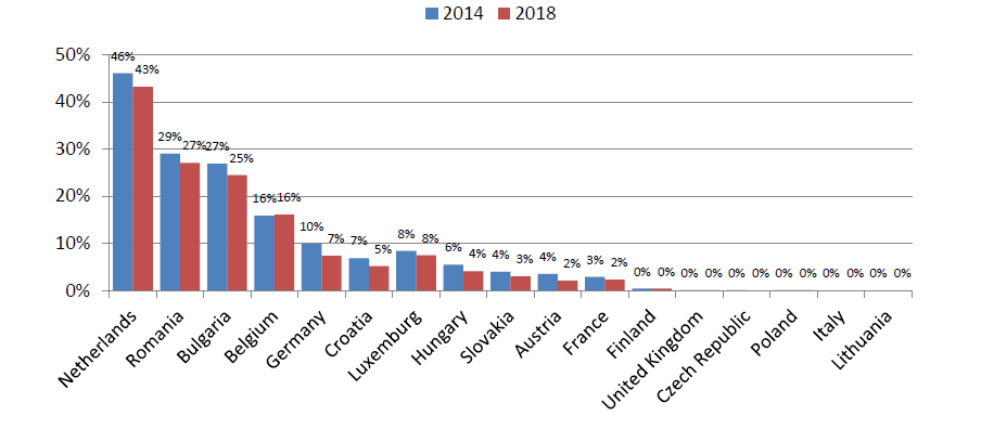
The share of shipping in the transport of goods in EU countries (Bayer et. al. 2021, CCNR report)
The downward trend in the share of inland shipping in freight transport of goods has been observed in Western Europe for years. In 2018, in Germany and France – the “flagship” countries, which are given as a model by the supporters of Polish waterways, inland waterways transported less than 10% of all goods (7% and 2%, respectively).
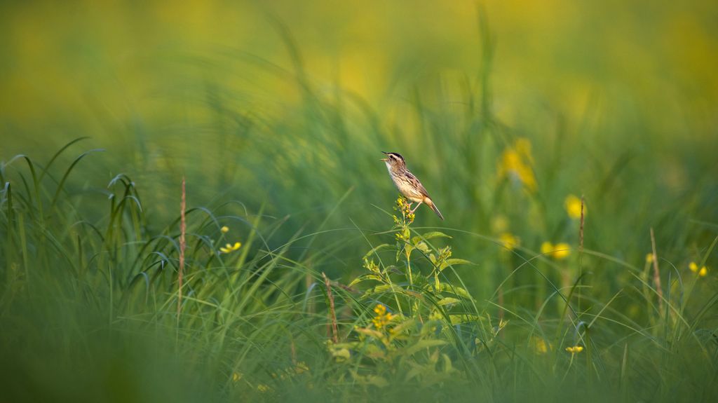
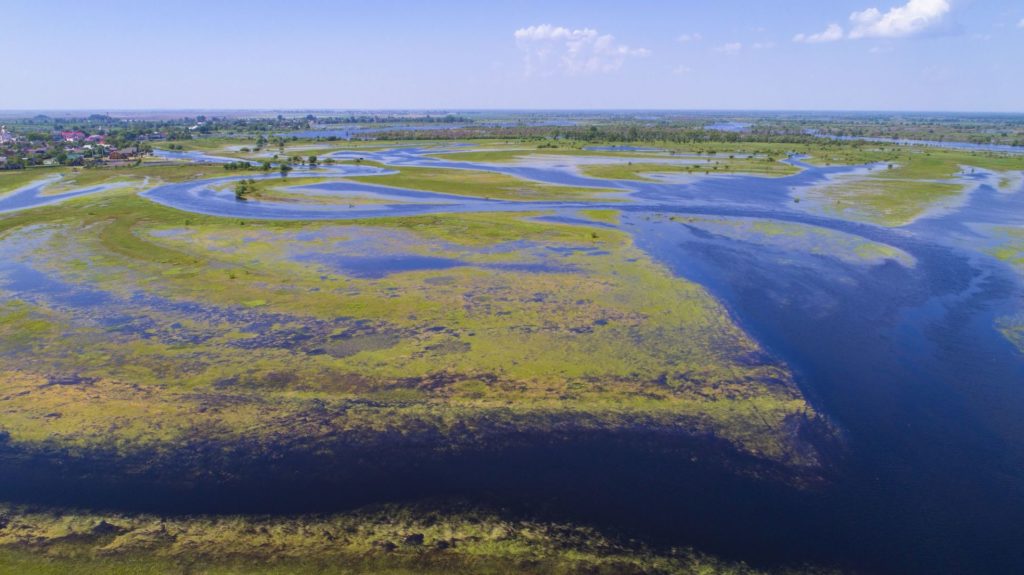
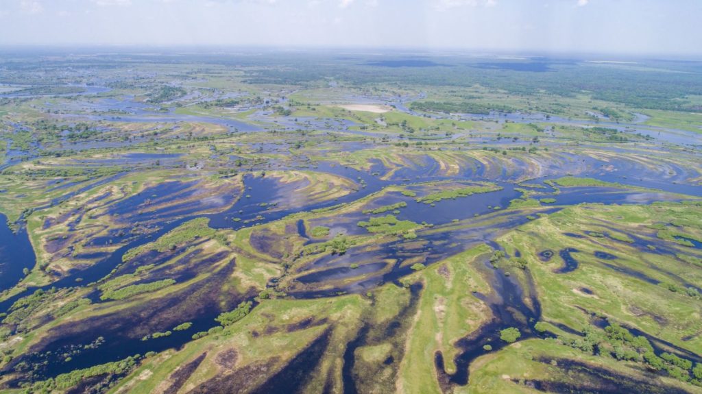
All photos on this page: (c) Daniel Rosengren / FZS